Join the waitlist

Join the waitlist now.

Site scouting, 3D planning and bankable assessments from independent firms on one platform. Sign up and be the first to know when we launch.

  • Early access
    People on the waitlist are the first to get access to the platform.
  • Expertise from the assessor network
    Contributions from GEO-NET, anemos, I17-Wind, planGIS and IEL.
  • Launch updates
    Launch date, new features and invitations to webinars.

Only a few relevant emails. Unsubscribe at any time.

Join the waitlist

Free, with no obligation. Required field: email address.

You will receive a confirmation by email.

Data backbone & accredited assessments from

What sets us apart

  • Measurements, data collection and assessments under one roof
  • A second opinion at the push of a button
    From independent assessors, on one digital platform
  • Separate data rooms
    Data only goes to the firm you commission
  • Hosted in Germany
    Servers and AI in Germany, GDPR-compliant

Assessments that banks and authorities trust.

Independent, accredited assessors and a platform that makes every step traceable, from the first site to financing. Less complexity, more focus on the project.

  • A track record of many years of wind assessments and thousands of completed projects in Germany, Europe and worldwide

  • Forecasts confirmed in operation

    Lower uncertainty = better bankability

  • DAkkS-accredited assessors

    GEO-NET, anemos, I17-Wind and IEL to DIN EN ISO/IEC 17025. GEO-NET is a leading international assessor for wind measurement and wind resource. Its accreditation and MEASNET membership make its work internationally recognised.

“The power of the wind: precisely calculated, perfectly used.”
WINDIQ vision statement
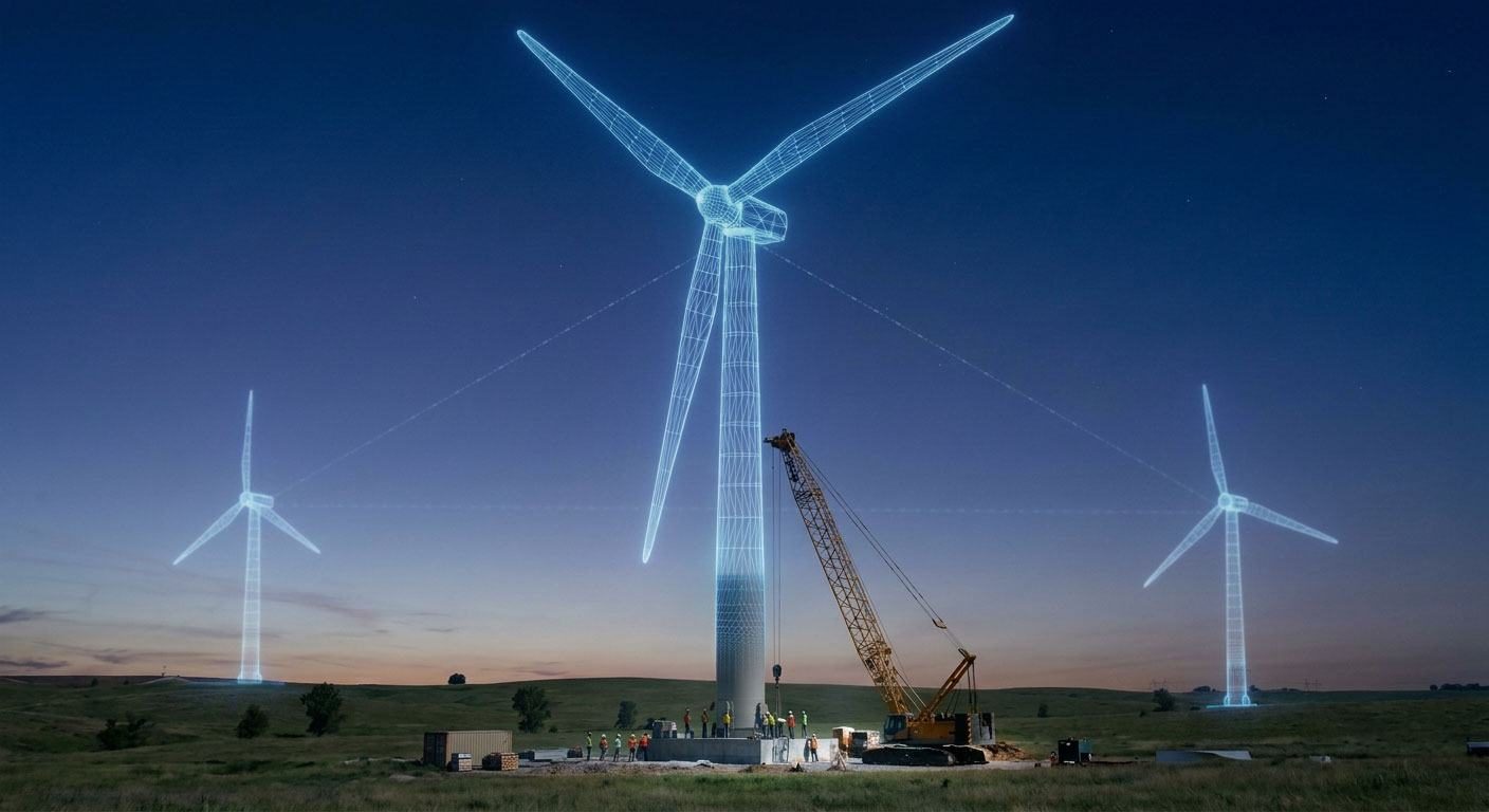
Wind turbines as digital twins above a construction site

Digital twins of your wind farms

Analyse the terrain in real time.

  • First-hand expertise in the guidelines

    From years of active work on FGW committees

  • Wind field models adapted to each site

    WAsP and CFD

  • Assessments to MEASNET standards

    Internationally recognised and bankable

Services

Five assessor firms. One shared platform.

GEO-NET, anemos, I17-Wind, planGIS and IEL: independent firms, each with its own expertise.

Meet the network →

The entire project lifecycle

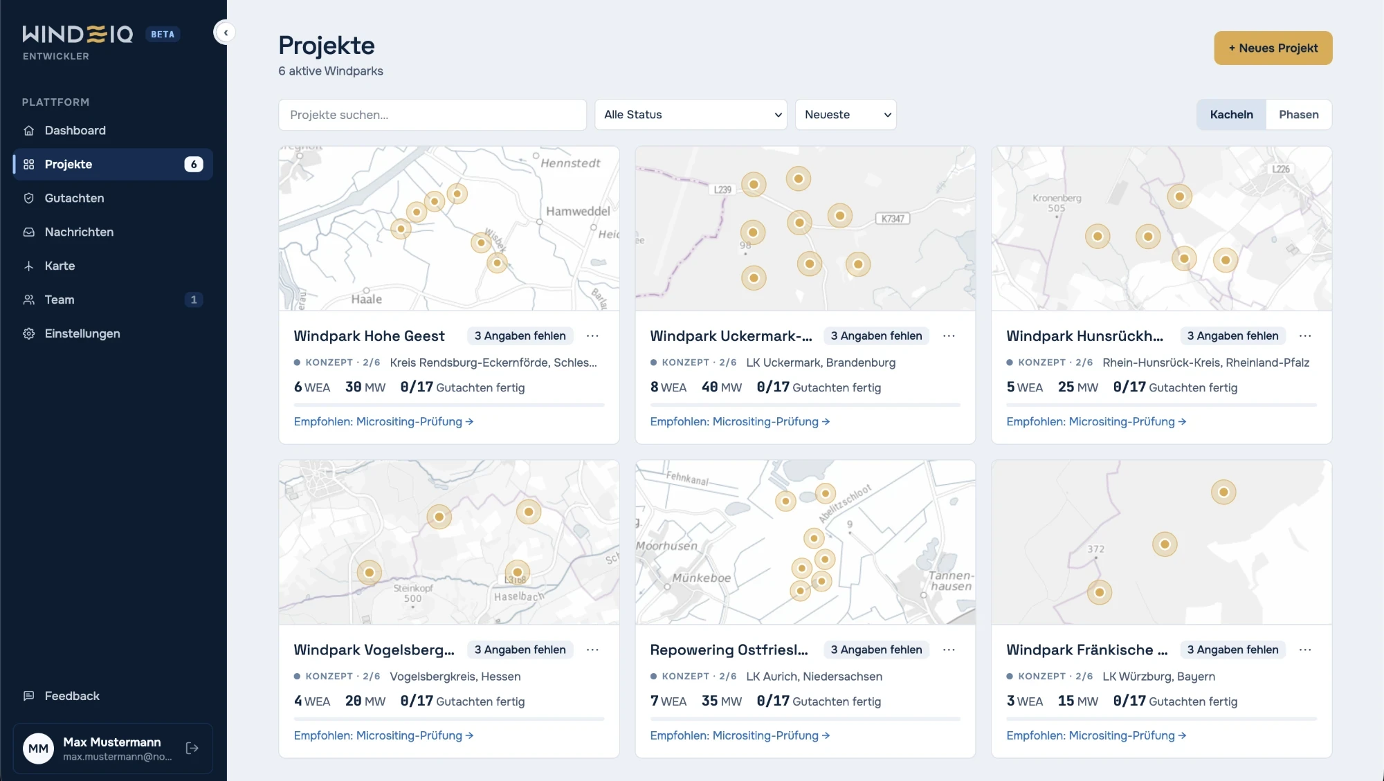
WINDIQ project overview with wind farm cards, turbine count, capacity and assessment status

All projects at a glance

Wind farms and assessment status in one shared project overview.

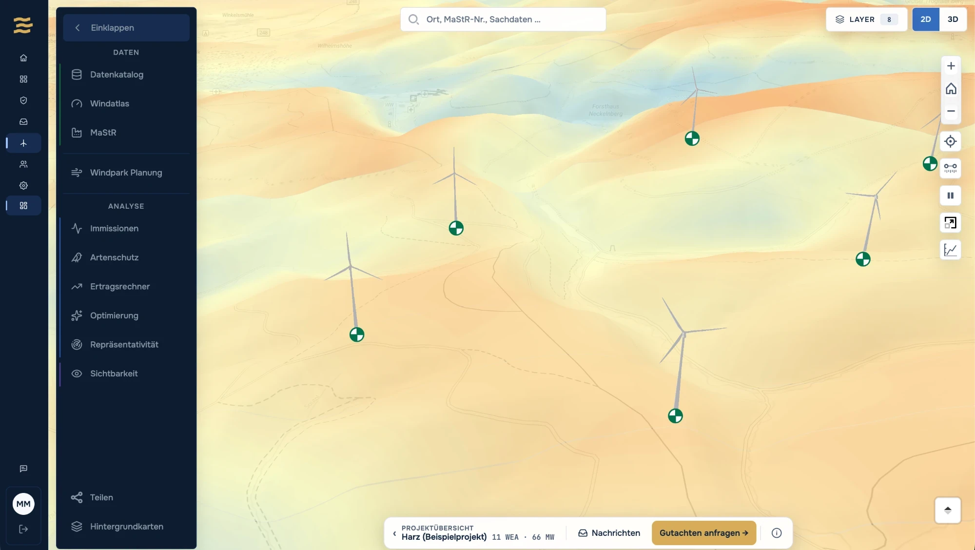
WINDIQ map with wind turbines in the terrain model and analyses such as noise and shadow flicker, species protection and a yield calculator

Check sites in 3D

View turbines and terrain in 3D and open site analyses right inside the project.
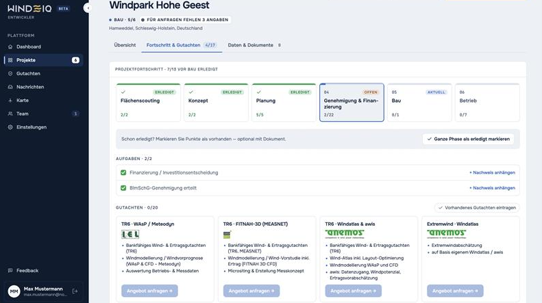
WINDIQ project page with project phases, tasks and assessment quotes from the firms

Track progress and assessments

Project phases, tasks and assessments for each wind farm at a glance.

Wind turbine above a misty landscape

Ready for your next wind farm?

Get started in seconds. No setup required.

Sign up for free